Climbing Hazrat Sultan (2026): Uzbekistan's Highest Peak and What the Trek Really Involves
· 10 min read · Adventure
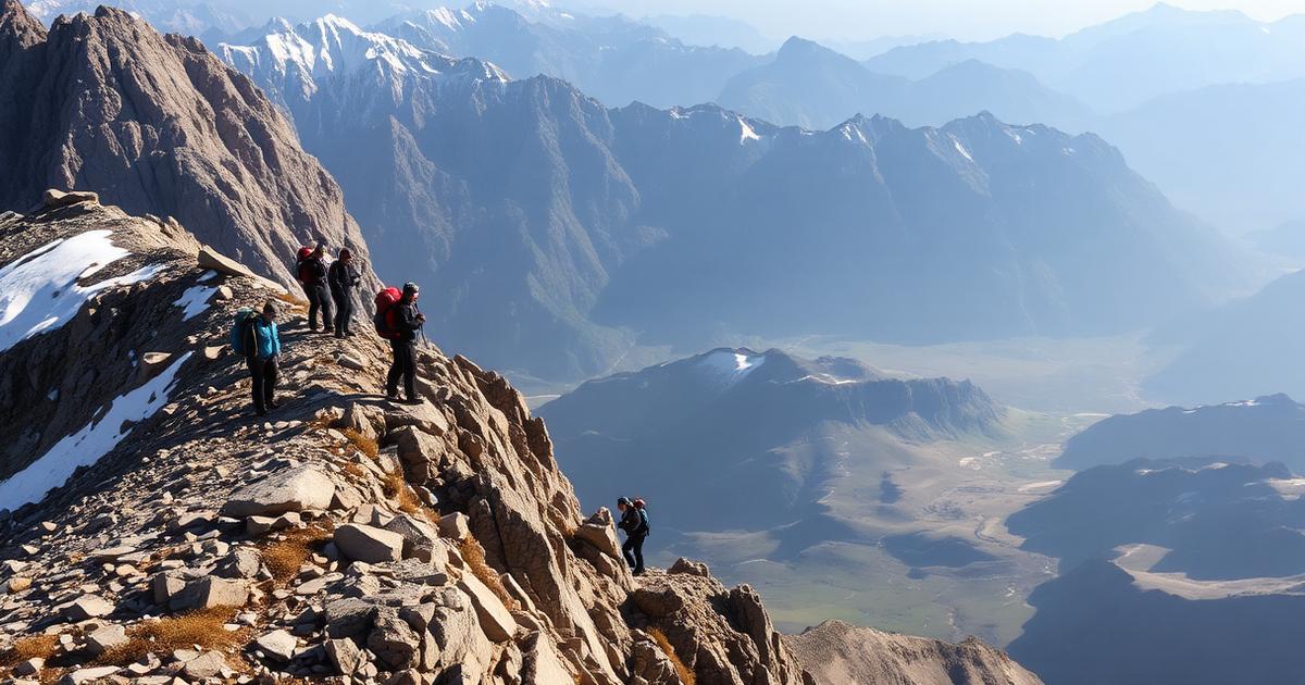
Uzbekistan's highest mountain sits at 4,643 metres on the Tajik border, far from any tourist route. It is reachable without technical climbing — but not without planning.
Most visitors leave Uzbekistan believing it is a desert country with some hills near Tashkent. In fact its south-east corner rises into the Gissar range, and its highest point — Hazrat Sultan, at 4,643 metres — is a serious mountain by any standard. It sits on the border with Tajikistan in Surxondaryo province, hundreds of kilometres from the Silk Road cities, and it receives a tiny fraction of the traffic that comparable peaks get elsewhere in Central Asia. That is both the appeal and the problem.
Where it is and why that matters
The peak lies in the Gissar (Hisor) range within the wider Surxondaryo highlands, accessed from the Boysun and Sherobod side. The nearest useful town for logistics is Boysun; Termez is the regional hub with an airport and rail connections. Getting there from Tashkent is a full travel day by air to Termez plus road, or a long overnight train followed by several hours of driving. Nobody does this as a side trip from Samarkand.
The border complication
The summit area sits on the state border with Tajikistan, and the approach passes through a border zone. This is the single most important planning fact: independent walk-up attempts are not appropriate here. Permits for the border zone are required, they take time to arrange, and they are handled through local operators who deal with the relevant authorities. Turning up in Boysun and hoping to sort it out on the day does not work.
What the trek involves
The standard approach is a multi-day trek rather than a technical climb. Expect four to seven days depending on the route and acclimatisation plan, with camps in high valleys, long days on scree and boulder fields, stream crossings, and a final ascent that is steep and exposed but does not normally demand ropework in good summer conditions. Snow lingers late and returns early; outside the narrow season it becomes a mountaineering objective rather than a trekking one.
Fitness and altitude
- Base level: comfortable with consecutive eight-hour hiking days carrying a daypack, with a porter or pack animal taking camp weight.
- Altitude: 4,643 m is high enough for altitude sickness. Build in acclimatisation days; do not compress the itinerary to save time.
- Terrain: loose scree, no maintained path for much of the route, and route-finding that genuinely needs local knowledge.
- Weather: afternoon storms are common in summer; most groups aim to be off the highest ground by early afternoon.
Season
July to early September is the window, with August the most reliable. June often still has significant snow on the upper sections and swollen streams from melt; late September brings the first serious cold and the risk of being snowed on high. Outside that, treat it as a winter mountaineering trip requiring an entirely different level of experience and equipment.
Guides, cost and logistics in 2026
There is no self-service infrastructure — no huts, no marked trail, no rescue post. Everything goes through a small number of Tashkent and Surxondaryo-based adventure operators who arrange permits, transport from Termez or Boysun, a mountain guide, cook, pack donkeys or horses and camp equipment. Expect a full organised expedition to cost in the region of several hundred to well over a thousand US dollars per person depending on group size and duration, with small groups substantially more expensive per head. Book months ahead; these operators run only a handful of departures a season.
What to bring
- Four-season sleeping bag — high camps get well below freezing even in August.
- Proper boots with ankle support, and trekking poles for the scree descents.
- Full sun protection: high-altitude UV plus reflective snow is brutal.
- Water purification, because refills come from streams.
- Personal first aid including altitude medication discussed with your doctor in advance.
- A satellite messenger, since mobile coverage is absent for most of the route.
The alternatives if this is too much
Hazrat Sultan is not the right objective for most travellers, and Uzbekistan has genuinely rewarding mountain options that need neither permits nor expedition planning. Zaamin National Park offers forested walking at moderate altitude, the Nuratau range has village-to-village homestay treks, and Chimgan and Beldersay near Tashkent give you a day in real mountains with a chairlift and a taxi home. Choose the peak only if summiting the country's highest point is the actual goal.
Responsible practice
This is a lightly visited, ecologically sensitive range close to a sensitive border. Carry out everything you carry in, camp on durable ground, do not light fires in the juniper zone, and follow your guide's instructions about photography near border installations without argument. The access that exists here depends on visitors not creating incidents.
Bottom line
Hazrat Sultan is Uzbekistan's most serious trekking objective and one of the least-known 4,600-metre peaks in Central Asia. It is achievable for a fit hiker with a good operator in August, and impossible to improvise. Plan it as an expedition, budget a week, arrange permits months in advance, and treat the altitude with respect.